Find your Councillor
Find your councillor by postcode
List of all Councillors List of Councillors by ward
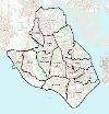
Ward Map
Maps for each ward:
Alverstoke (PDF, 736 KB) | Anglesey (PDF, 815 KB) | Bridgemary (PDF, 1 MB) | Brockhurst and Privett (PDF, 958 KB) | Elson (PDF, 941 KB) | Forton (PDF, 926 KB) | Grange and Alver Valley (PDF, 709 KB) | Harbourside and Town (PDF, 777 KB) | Hardway (PDF, 695 KB) | Lee East (PDF, 1 MB) | Lee West (PDF, 1 MB) | Leesland and Newtown (PDF, 704 KB) | Peel Common (PDF, 849 KB) | Rowner and Holbrook (PDF, 847 KB)


